
The moment you land in Washington, D.C., you sense the city is unique. The highways appear to be more orderly, there are few buildings taller than a certain height, and yet the entire city seems to have been positioned with great precision as though being displayed in an open-air museum or as though it were a giant outdoor chess board.
One of the most curious aspects of the city is the location of the markers that delineate Washington, D.C., can actually be found outside of the national landmark sites such as the White House and the Capitol Building, in various neighborhoods throughout the city, behind fences, within parks, and sometimes within private residences. These markers remain quiet and unnoticed by most passersby even though these markers represent what once were a part of the original boundary lines of our Capital in the 1700s.
The collection of markers established the surface area of the District of Columbia in the form of a diamond-shaped region with dimensions stretching approximately 10 miles out in each direction. The shape becomes almost unbelievable on a modern-day plan of D.C. There were also sections of what is presently Alexandria, Virginia, which were included within The District 200 years ago.
At the outset, Washington, D.C., was intended to appear vastly different from any other American city. Rather than growing over centuries of commerce and industry as New York, Boston, and Philadelphia have done, D.C.’s design has always been deliberate and is more akin to a monumental political statement embedded within the landscape.
Pierre Charles L’Enfant, the designer of our capital, envisioned Washington, D.C., to be much more spectacular than a mere rectangular grid system. He proposed broad ceremonial avenues, massive public open spaces, and points of view from important buildings toward one another. His major influences were, in part, the formal gardens of royal palaces in Europe as well as Baroque city planning like that of Versailles.
Because of the significant size of the streets and the unusual layout of the streets, Washington, D.C., has an odd air of dignity that many American cities lack. The design of the streets has not only been based on the same North-South/East-West system as other American cities; there are diagonal streets cutting through the grid at varying angles, resulting in concentric circles, plazas, and intersections that continually cause your eyes and mind to move from one monument to another, or from a monument to a governmental building.
The Capitol Building stands as the central hub of the city; therefore, all areas of the city extend outward from the Capitol Building. Based on this layout, streets are identified into one of four quadrants: Northwest (NW), Northeast (NE), Southwest (SW), and Southeast (SE).
The first time you visit, this can be confusing; you’ll think you’re on the right road only to find that you have missed the mark altogether. When you figure out the layout of the city, though, you’ll be surprised by how easy it is to get around.
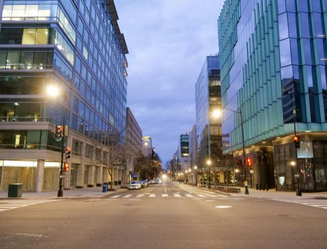
People who come here will immediately notice a lack of tall buildings in comparison to other large metropolitan areas like Chicago or New York City. The skyline of Washington DC doesn’t feel as tall or dense as those other cities do. Many people speculate that the reason for this height restriction is that no building can be taller than the dome on the Capitol; however, that’s actually not the reason.
When the first tall apartment building in the city was built many people freaked out. Steel frame construction was still new at the time and the people living near the building were afraid it would collapse or that a fire would render the building unmanageable. Because of the fear and concern of the people living around the first tall building and the knowledge of how far firefighting equipment could reach, the local government created strict height regulations for all buildings in the city.
This decision permanently changed how the city of Washington DC looks today. The city no longer grows vertically; rather, it expands out. Because of that, the monuments, domes, and memorials still dominate the landscape in Washington DC.
This huge green corridor is located in-between eight different, famous American landmarks. On one end you have the Capitol Building and the other end is the Lincoln Memorial. In between these two landmarks you have museums and monuments as well as many large open spaces that have served as protest sites, places to celebrate, and locations of major speeches and important gatherings over many generations.
The Washington Monument towers over the city near the center like a giant stone compass needle pointing upward into the sky. Interestingly enough, the Washington Monument was not finished until decades after it was first started due to political disagreements along with funding difficulties. For a number of years it looked odd to see it just as it was because it appeared incomplete prior to eventually becoming one of the city’s major landmarks.
Pennsylvania Avenue, which runs from the White House to the Capitol Building, is one of the most politically significant streets in the United States and is considered to be the principal avenue for political representation in Washington D.C. The other avenue we will discuss ties into the fact that Massachusetts Avenue became famous because of Embassy Row. Embassy Row has historically been home to many foreign embassies that utilize Massachusetts Avenue for their consular office headquarters.
Many American cities lack the international feel that having so many embassies in Washington, D.C., creates for the city. In some neighborhoods, as you walk down the street, it seems like you are moving between several different countries rather than just through one city.
Georgetown is another area of Washington, D.C., that adds to the city’s character. Georgetown was established before the capital of Washington, D.C., was ever created. The streets, homes, and waterfront of Georgetown all predate most of Washington, D.C., and have a completely different look than the other parts of the city, which reflect the geometric pattern of the streets found throughout the District of Columbia.
Another surprising part of Washington, D.C., is Rock Creek Park. Rock Creek Park has sections that include large areas of forest, miles of hiking trails, picnic areas, and even a zoo. When you consider that Washington, D.C., is known for being a political city with a large presence of government, the large amounts of green space within the city are thought of as being quite peaceful by many.
Washington, D.C., is closely associated with a history of conflict and division. At the time of the Civil War, Washington, D.C., was made up of land on both sides of the Potomac River; however, at the end of the Civil War, much of the area on the western side of the Potomac River was given back to Virginia, in part because of disagreements about slavery and representation.
Opposite this river is the historic burial ground of Arlington National Cemetery, as one of the most moving locations within American history. During the Civil War, Arlington was established as the nation’s largest burial ground, serving as a final home to hundreds of thousands of fallen soldiers. The land on which Arlington sits was owned by Robert E. Lee previously, as he commanded the troops in the battle in which Washington D.C. is located.
In every corner of Washington D.C., the vast web of connections between the many corners of history creates an intriguing place. Washington D.C. is not only a collection of memorials; it represents an enormous political representation materialized into physical form.
Today the original vision continues to influence everyone’s experience of the City. The buildings are low enough to not block monuments. The large parks create opportunities to come together and hold demonstrations. The diagonal streets give shapes to the views. The old rock markers still exist around the various neighbourhoods and suggest where it was all started many years ago.
Washington, D.C., may appear to be organised on the outside, but underneath that neat appearance there are centuries of political intention, architectural meaning, compromise, and conflict. This is what adds to the special energy of the city. Each road, monument, and boundary line has been created for a reason greater than the structure itself.